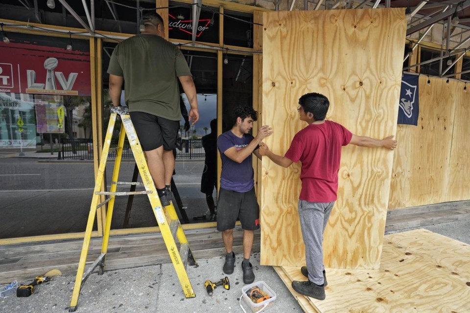
Feeding on some of the hottest water on the planet, is rapidly strengthening as it bears down on Florida and the rest of the Gulf Coast. It’s been happening a lot lately.
“It’s 88, 89 degrees (31, 32 degrees Celsius) over where going to be tracking, so that’s effectively rocket fuel for the storm,” said Colorado State University hurricane researcher Phil Klotzbach. “It’s basically all systems go for the storm to intensify.”
That water “is absurdly warm and to see those values over the entire northeast Gulf is surreal,” said University of Miami hurricane researcher Brian McNoldy.
Hurricanes . Idalia is at an all-you-can-eat buffet.
“What makes this so tough and so dangerous is” that Idalia is moving so fast and intensifying so rapidly, some people may be preparing for what looked like a weaker storm the day before instead of what they'll get, said National Weather Service Director Ken Graham.
Idalia “stands a chance of setting a record for intensification rate because it’s over water that’s so warm,” said MIT hurricane professor Kerry Emanuel. On Tuesday, only a few places on Earth had conditions — mostly warm water — so primed for a storm's sudden strengthening, he said.
“Right now I’m pretty sure Idalia is rapidly intensifying,” Emanuel said.
At the time Emanuel said that, Idalia was clocking 80 mph winds. A couple hours later it was up to 90 mph, and by 10 p.m. Idalia was a Category 2 hurricane with 110 mph winds, having gained 40 mph in wind speed in 21 hours. A storm officially rapidly intensifies when it gains 35 mph in wind speed in 24 hours.
Scientists have been talking all summer about how record , especially in the Atlantic and near Florida, and how deeper water — measured by something called ocean heat content — keeps too because of human-caused climate change. The National Hurricane Center’s forecast discussion specifically cited the ocean heat content in forecasting that Idalia would likely hit 125 mph winds before a Wednesday morning landfall.
Idalia’s “rapid intensification is definitely feeding off that warmth that we know is there,” said University at Albany atmospheric sciences professor Kristen Corbosiero said.
That warm water is from a mix of , a natural El Nino and other random weather events, Corbosiero and other scientists said.
And it’s even more. Idalia has been parked at times over the Loop Current and eddies from that current. These are pools of extra warm and deep water that flow up from the Caribbean and into the Gulf of Mexico, Corbosiero said.
Deep water is important because hurricane development is often stalled when a storm hits cold water. It acts like, well, cold water thrown on a pile of hot coals powering a steam engine, Emanuel said. Often storms themselves pull the brake because they churn up cold water from the deep that dampens its powering up.
Not Idalia. Not only is the water deeper down warmer than it has been, but Idalia is going to an area off Florida’s western coast where the water is not deep enough to get cold, Emanuel said. Also, because this is the first storm this season to go through the area no other hurricane has churned up cold water for Idalia to hit, Klotzbach said.
Another fact that can slow strengthening is upper level crosswinds, called shear. But Idalia moved into an area where there’s not much shear, or anything else, to slow it down, the hurricane experts said.
A hurricane getting stronger just as it approaches the coast should sound familiar. – Delta, Gamma, Sally, Laura, Hannah and Teddy – rapidly intensified. Hurricanes Ian, Ida, Harvey and Michael all did so before they smacked the United States in the last five years, Klotzbach said. There have been many more.
Storms that are nearing the coastlines, within 240 miles (400 kilometers), across the globe are rapidly intensifying three times more now than they did 40 years ago, a study published last week found. They used to average five times a year and now are happening 15 times a year, according to a
“The trend is very clear. We were quite shocked when we saw this result,” said study co-author Shuai Wang, a climatology professor at the University of Delaware.
Scientists, such as Wang and Corbosiero, said when it comes to a single storm such as Idalia, it’s hard to blame its rapid intensification on climate change. But when scientists look at the big picture over many years and many storms, other studies have shown a
In his study, Wang saw both a natural climate cycle connected to storm activity and warmer sea surface temperatures as factors with rapid intensification. When he used computer simulations to take out warmer water as a factor, the last-minute strengthening disappeared, he said.
“We may need to be a little bit careful” in attributing blame to climate change to single storms, Wang said, “but I do think Hurricane Idalia demonstrates a scenario that we may see in the future.”
___
Follow AP’s climate and environment coverage at
___
Follow Seth Borenstein on Twitter at
___
Associated Press climate and environmental coverage receives support from several private foundations. See more about AP’s climate initiative The AP is solely responsible for all content.
Seth Borenstein, The Associated Press


